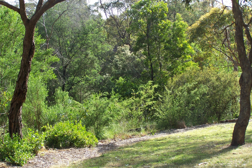
Cootamundra Walk is a bushland park in North Blackburn. It is a linear park comprised of two sections that follow the course of the now mostly underground Blackburn Creek which is a tributary of KooyongKoot. Blackburn Creek joins Gardiners Creek in the Blackburn Creeklands (Blacks Walk).
The park features one of the last remnants of bushland north of Whitehorse Road, playgrounds and pockets of revegetated bushland.
Location
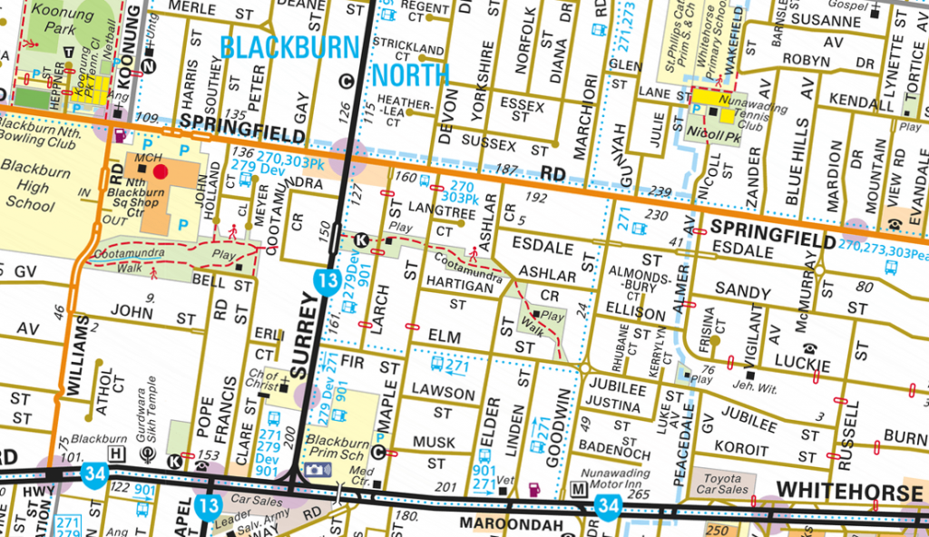
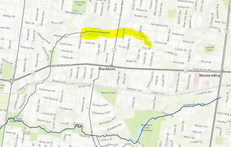
The park is about 1km long and made up of two sections:
- The western section preserves natural bushland at the rear of the North Blackburn Square Shopping Centre. It features an open creek and revegetated parkland which runs east from Williams Road to Cootamundra Crescent.
- The eastern section starts in Surrey Road where revegetated parkland extends through to Elm Street near its junction with Goodwin Street. East meets west via a quiet and short local street.
Relevant Friends’ Group
The Cootamundra Walk Advisory Committee is the relevant friends’ group. Predecessors of the group have been running since 1975 with the committee established in 1978 when a group of local residents saw the need to protect and revegetate remnant bushland during the extension of the local shopping centre. Today it consists of local volunteers appointed by Whitehorse City Council and meets once every two months to organise working bees and community events.
Current projects and activities include:
- Weeding and planting working bees.
- The group hosts the popular annual event “Music in the Park“.
Web-site: https://cootamundrawalk.wordpress.com/
Facebook: Friends of Cootamundra Walk
E-mail: <e-mail link to be provided>