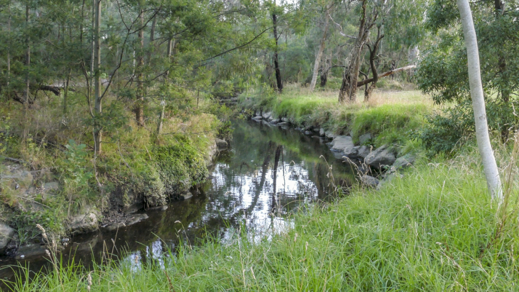
“KooyongKoot” is the name of today’s Gardiners Creek in the Woi Wurrung language used by the Wurundjeri peoples.
It is a major tributary of the Yarra River (Birrarung in Woi Wurrung).
[Link to history page and the ecology page.]
Catchment
Actually, our interest extends from the creek itself to its entire catchment. The catchment is the area that supplies the water that flows into the creek. This map shows KooyongKoot’s entire catchment:
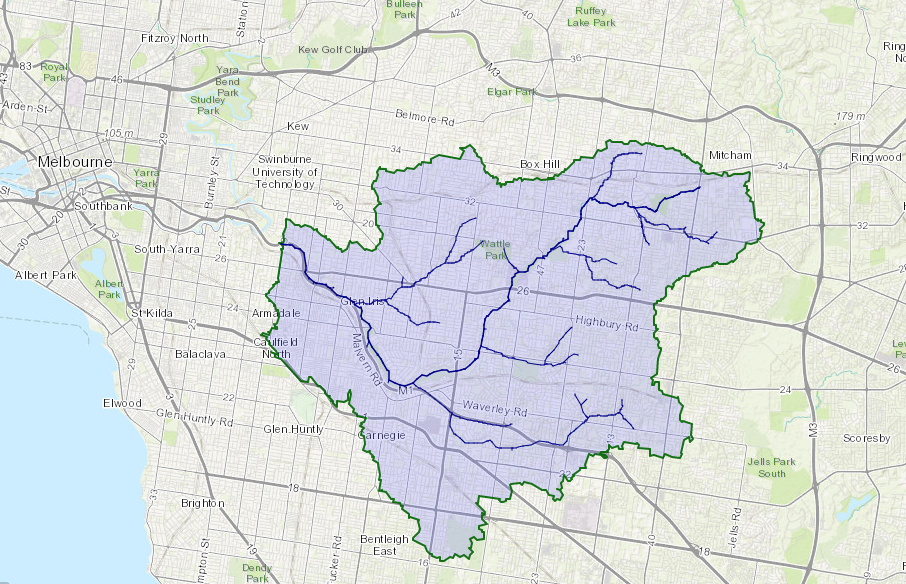
Its range is surprising – reaching Mitcham in the east, Oakleigh South to the south, Balwyn and Blackburn North to the north before flowing into the Yarra at Hawthorn to the west. KooyongKoot has its own tributaries – Back Creek (Surrey Hills – Glen Iris), Damper Creek (Mount Waverley-Ashwood) and Scotchmans Creek (Wheelers Hill-Glen Waverley-Mount Waverley-Oakleigh-Chadstone).
Issues and Needs
For too long, KooyongKoot has been regarded primarily as a drain …
Ecological Issues
The catchment contains biodiversity hotspots, including areas of remnant original habitat (such as at Blackburn Lake Sanctuary), but they are fragmented and without effective connection (biolinks).
The general ecological state is poor. There is declining canopy and understorey coverage.
Councils in the area, Melbourne Water and the KKA alliance of friends groups have long been actively involved in ecological restoration – but there is still much work to do!
Water Quality
The catchment is impacted by continuing water quality and pollution issues as a result of the predominant urbanisation of the catchment and the resulting changes to stormwater flows. There can be a dismissive attitude towards litter and pollution – out of sight, out of mind. The KKA sees a role to educate and to take action on pollution and littering.
Management of litter and pollution generally is important in conserving our vegetation and green spaces.
Integrated Water Management
Implementing integrated water management is essential. There is a need to enhance and protect the catchment in response to increasing urban densification, population growth and to adapt to climate change.
Urban Heat Island Effects
Restoring and maintaining vegetation, increasing green space and increasing tree canopy cover is essential to combat the Urban Heat Island effect in the suburbs. There are also direct benefits in supporting biodiversity and the wellbeing of local communities through connection to nature and for recreation.
An urban heat island is an urban area that is significantly warmer than its surrounding rural area due to human impacts. The temperature increase tends to be larger at night and is most noticeable both when winds are weak and during summer and winter. The main cause of the effect is the modification of land surfaces with waste heat from energy use a secondary contributor.
Nearly 40 percent of the increase is believed to be due to the prevalence of dark rooves, with the remainder coming from dark-colored pavement/roads and the declining presence of vegetation. Anecdotally, we know of several locals who regularly walk along KooyongKoot on hot summer nights to refresh themselves because they know it is much cooler there than inside their houses… We also know that parks “lower our temperature” psychologically too.