The Ecology of an area like the KooyongKoot catchment is the study of what organisms exist in it and how they interact with one another and their physical environment. It looks at the distribution and abundance of organisms, shaped by both biotic (living organisms) and abiotic (non-living) factors such as the area’s geology, landscape and climate.
In this introduction, the Ecology Page provides an overview of the ecology of KooyongKoot considering fauna, flora, water and human settlement.
Our Bioregion and Ecological Vegetation Classes
Bioregions are a very broad-scale approach to classifying the environment using a range of attributes such as climate, altitude, geology, soils and vegetation. Of the 28 bioregions identified in Victoria, all of the KooyongKoot catchment falls within the Gippsland Plain bioregion.
Most of the catchment has been disturbed due to exploitation for resources and, later, urbanisation – watercourses have been significantly modified, forests and other vegetation have been cleared and suburbs have been built. Note: to improve biodiversity, some Local Governments are looking at “daylighting” creeks piped underground.
Ecological Vegetation Classes (EVCs)
Each bioregion contains a number of EVCs. EVCs are the standard unit for classifying vegetation types in Victoria. The EVC benchmarks contain a subset of typical (but not complete) lists of plant species for each EVC within a bioregion.
NatureKit is an on-line mapping and data tool for biodiversity provided by the Victorian State Government. Access is free of charge. NatureKit displays information on various datasets including EVC data mapped over the entire State. The maps following are snapshots from NatureKit.
Pre-1750 EVC mapping is a model of the assumed pre- European settlement vegetation types. The 2005 mapping is assumed to be a present-day model.
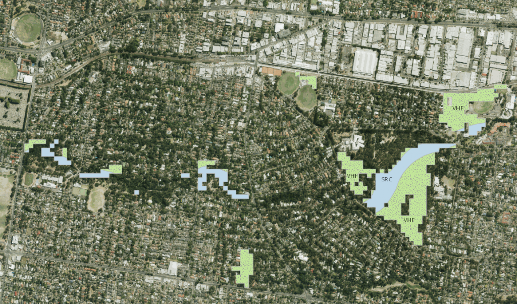
The map above shows the 2005 model for the upper reaches of the Gardiners Creek catchment showing remaining areas of Valley Heathy Forest (dotted pale green labelled VHF), including a small area of Valley Grassy Forest and Swampy Riparian Complex and Swampy Riparian Woodland (pale blue) along the water courses. The largest area is the Blackburn Lake Sanctuary and Gardiners Creek flows east-west roughly through the centre of the photograph.
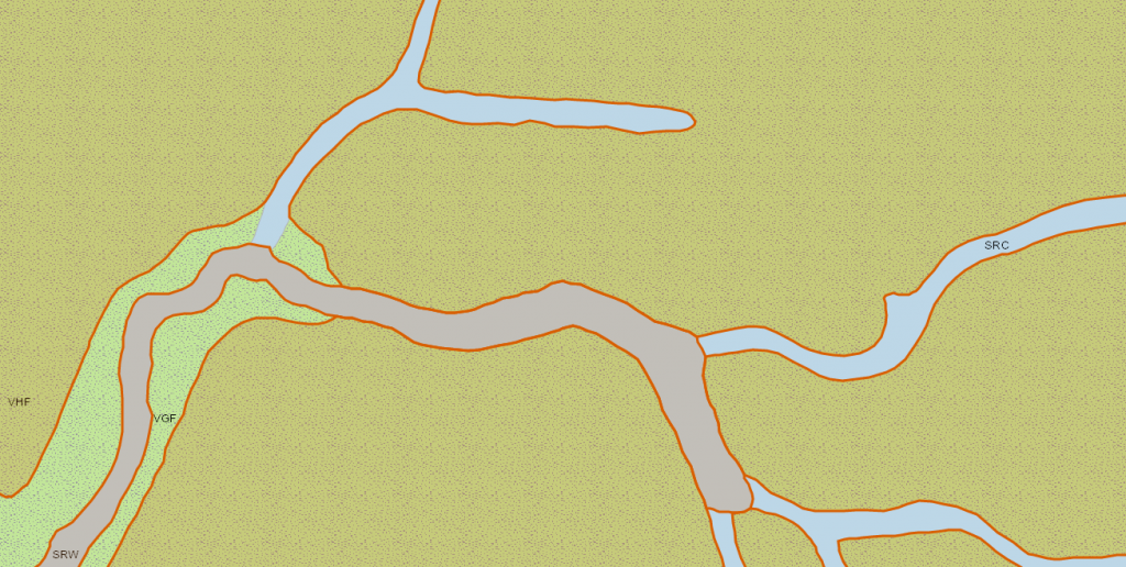
The diagram above shows the pre-1750 version of the same area. Each EVC within a bioregion is numbered and contains “benchmark” data including the types and proportion of vegetation (eg canopy trees and understorey), a list of typical species and how much leaf-litter and what density of logs should be present.
| EVC | Full name and code |
|---|---|
| VHF | Valley Heathy Forest (127) |
| VGF | Valley Grassy Forest (47) |
| SRC | Swampy Riparian Complex (26) |
| SRW | Swampy Riparian Woodland (83) |
When revegetating a site, we use the pre-1750 EVC for guidance – eg for plant lists appropriate to the area.
The list of most EVCs in the bioregion appears here for convenience.
The following map shows the old EVCs overlaid over the current built environment:
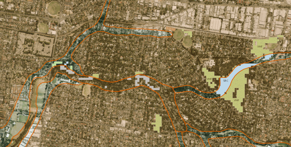
Like road reserves in the country where bush remains along roadsides, our watercourses do provide ribbons of connectivity for nature and wildlife.
The KooyongKoot Catchment
A more complex picture emerges when we look at most of the catchment where more than a dozen distinct EVCs exist:
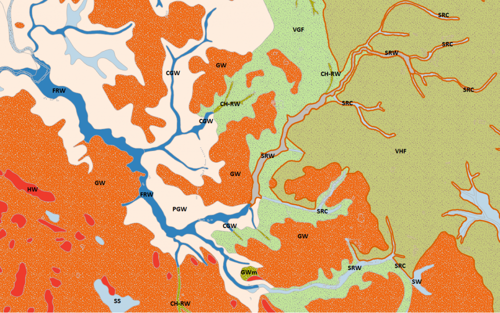
The closer we get to the junction of the creek and the Yarra (towards the top left where the blue FRW area widens), the more the Valley Heathy and Grassy Forests (VHF and VGF) give way to Grassy Woodlands (GW) and then Plains Grassy Woodland (PGW). Following the creek line, we see Swampy Riparian Complex (SRC), Swampy Riparian Woodland (SRW), Creekline Grassy Woodland (CGW) and Floodplain Riparian Woodland (FRW).
Creekline Herb-rich Woodland (HRW) tends to follow smaller tributaries flowing through Valley Heathy forest. Swampy Scrubs and Woodlands tend to coexist in a similar way with Grassy Woodlands. There are also isolated patches of Swamp Scrub (SS), Heath Woodland (HW) and an alluvial terrace of Grassy Woodland/Damp Sands Herb-rich Woodland Mosaic (GWm).
The inter-relationships between the landscape, the streamlines and vegetation classes are quite clear. Of course, there are similar inter-relationships between the vegetation/flora and local fauna. The overall ecological state in general of the catchment is poor due to urbanisation and increasing population densities. Particularly in the face of climate change, we need to conserve green spaces and the benefits that they provide (such as lessening the Urban Heat Island effect), reverse declining tree canopy and understorey coverage, connect areas in reasonable condition and promote a return of the biodiversity that is being lost.
The Future
One of our objectives is to restore biodiversity throughout the KooyongKoot catchment. The pre-1750 modelling of the catchment, taken along with the vegetation benchmarks, give us information on what the landscape looked like prior to European settlement and what plants might still grow well at specific sites. Obviously, we need to be aware of man-made interventions as well – for example, a creek piped underground is unlikely to be swampy.
So, generally speaking, if we revegetate along the creek lines which act as a habitat corridor, and build biolinks to other parts of the catchment including within our private gardens, there will be more habitat to help improve biodiversity.
As the famous saying goes, “if you build it, they will come”!
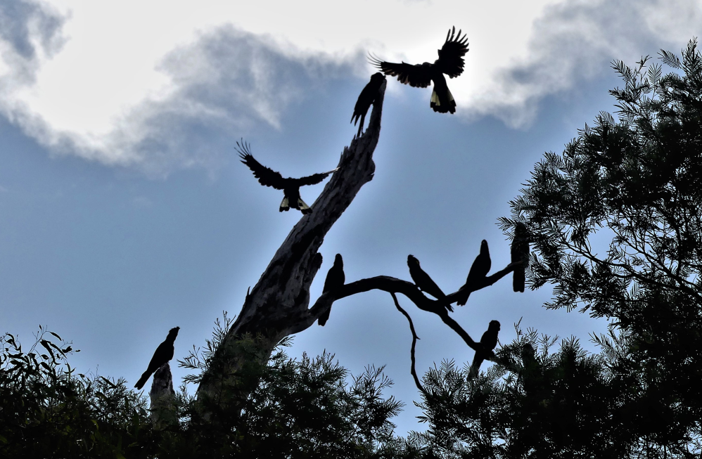
Fauna and Flora
Please visit our Fauna and Flora pages for further information on those topics.